On this page

Mapping Solutions for Smart Cities & Urban Planning
Building a thriving smart city is nearly impossible without location intelligence. This technology plays a crucial role in shaping the entire smart city ecosystem, helping to organize, coordinate, optimize, and forecast urban activities and conditions.
Stay updated on the latest geospatial innovations in smart cities, or reach out to us—we’re here to answer any questions and provide solutions tailored to your needs.
What Makes a Smart City
A smart city is defined by its ability to use advanced technologies, such as mapping software and location intelligence, to solve everyday urban challenges. Below are practical examples of how these innovations improve city life:
- Dynamic Public Transportation: Buses and trains that adjust schedules and routes based on real-time demand, ensuring efficiency during peak and off-peak hours.
- Real-Time Traffic Light Adjustments: Traffic signals that automatically adapt to current road conditions to reduce congestion and improve traffic flow.
- Smart Parking Systems: Sensors and apps that guide drivers to available parking spaces, reducing time spent searching and minimizing traffic.
- Automated Waste Collection: Trash bins equipped with sensors that notify when they are full, allowing for more efficient waste collection routes.
- Smart Street Lighting: Streetlights that dim or brighten based on the presence of pedestrians or vehicles, reducing energy consumption.
- Public Safety Alerts: Real-time notifications sent to residents’ phones in the event of emergencies, such as accidents, natural disasters, or public safety incidents.
- Accident Response Systems: Automated systems that provide emergency responders with live data on traffic conditions and alternate routes during accidents.
- Air Quality Monitoring: Sensors that track air quality in different parts of the city and provide real-time updates to residents and city officials.
These innovations help reduce operational costs, conserve resources, and enhance public safety. As technology continues to evolve, smart cities will play a key role in shaping the future of urban living, making daily life more convenient and connected for all residents.
Smart City Solutions: How Mapping Software and Location Intelligence Drive Improvement
Cities are fundamentally driven by location. With the advancement of maps and geospatial technologies, location-based challenges are now being transformed into data-driven decisions, making cities smarter, more efficient, and innovative.
Below are examples of smart city solutions that leverage mapping software and location intelligence to enhance urban living:

City Dashboards
Smart city dashboards are digital platforms that provide real-time insights into urban development, supporting intelligent governance through tools like maps, social media, and news.
Maps and location tools are essential in these dashboards, offering detailed city information:
- Map Tiles: highly detailed and customizable maps, offering a solid visual foundation for city dashboards.
- Routing API: provides precise route geometry for vehicles and public services that are displayed on the map.
- Isochrone API: is invaluable for emergency response, allowing city officials to visulize on the map areas that emergency vehicles can reach within specific timeframes.
- Places API: adds further value by showing nearby points of interest, such as hospitals, police stations, and other essential services, enabling quick access to vital resources.
- Address Autocomplete: enhances the user experience by allowing citizens or city operators to enter addresses quickly, with real-time suggestions.
City Insight Maps
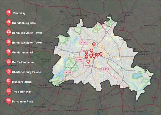
City Insight Maps are intuitive tools designed to help people, whether residents or visitors, explore and understand their city. These maps provide real-time data on everything from traffic conditions to local amenities, offering users valuable insights at a glance.
- Map Tiles: provides everyday users with detailed maps, making it easy for citizens, tourists, and commuters to navigate the city.
- Isochrone API: allows users to visualize how far they can travel within a set time, assisting with trip planning and optimizing their journeys around the city.
- Places API: enables users to discover nearby points of interest, such as restaurants, tourist attractions, healthcare facilities, and parks, enhancing their city experience.
- Reverse Geocoding API: converts geographic coordinates into human-readable addresses, helping users identify locations easily based on their latitude and longitude.
Real-time Asset Tracking
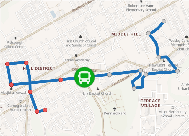
Real-time asset tracking greatly enhances the lives of citizens by providing instant access to valuable information about public services and deliveries. For instance, users can track the location of a bus via their smartphone, allowing them to plan their journeys more efficiently.
Additionally, they can monitor the progress of a delivery truck in real-time, improving transparency and overall satisfaction. By offering up-to-the-minute updates, real-time asset tracking ensures smoother experiences and greater convenience for everyone.
- Map Matching API: ensures accurate positioning of moving assets on the correct roads, even when GPS data is slightly inaccurate.
- Routing API: enables users to track the routes taken by buses or delivery trucks, showing the most efficient paths in real-time.
- Map Tiles API: provides detailed maps, allowing users to view the real-time locations of assets such as buses and delivery vehicles.
Geospatial Analytics
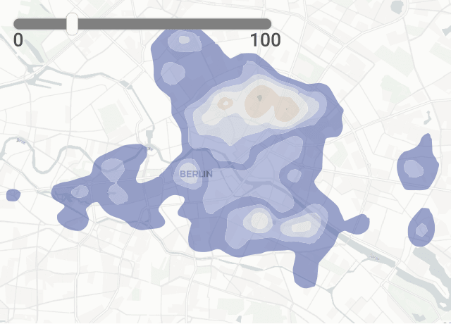
Geospatial analytics is essential for visualizing and understanding patterns and trends by creating data-driven maps.
These maps combine statistical data with visual elements such as heat maps or travel time maps, allowing authorities to gain insights into the current situation. By using geospatial analytics, they can predict how conditions will evolve and plan or implement effective solutions accordingly.
- Map Tiles API: provides a detailed map foundation, allowing geospatial data to be visualized clearly and effectively, helping users understand complex spatial patterns.
- Isoline API: creates travel time maps that help analyze areas reachable within specific timeframes, giving authorities insights into accessibility and service coverage.
- Geometry API: combines and analyzes spatial data by calculating intersections and unions of geometries, such as isolines, to reveal overlapping areas and trends.
- Boundaries API: defines and visualizes city boundaries or district-level data to provide clear context for geospatial analysis, enabling more precise planning and decision-making.
Route and Schedule Optimization Solutions
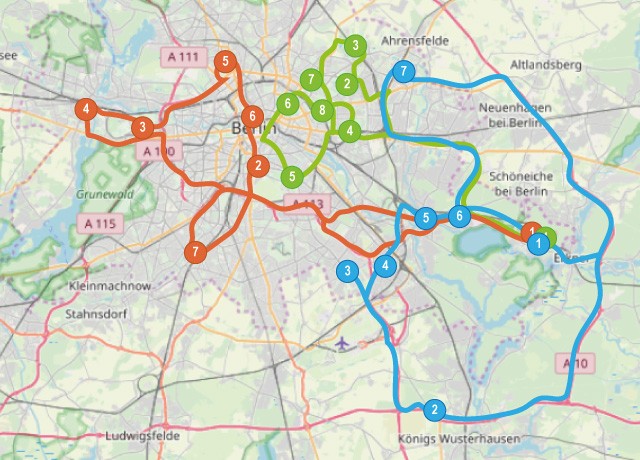
Route and schedule optimization are vital for enhancing the efficiency of both business and government services. By optimizing routes and schedules, organizations can reduce delivery times, minimize fuel or power consumption, and decrease the need for additional drivers.
In smart cities, these solutions play a key role in improving logistics. Cities can determine the most efficient routes for delivering goods, streamline transportation systems, and create optimized schedules for services and workers, ensuring resources are used effectively while reducing costs and environmental impact.
- Route Planner API: helps businesses and city planners optimize routes for deliveries and services by finding the most efficient paths, reducing travel time and fuel consumption.
- Map Matching API: ensures accurate tracking by aligning GPS data with the correct road network, improving route precision for vehicles and public services.
- Time-Distance Matrix API: calculates the travel time and distances between multiple locations, enabling better scheduling and assignment of tasks for workers or deliveries.
- Routing API: provides turn-by-turn navigation and route geometry, allowing drivers to follow the most optimal routes and avoid delays, ensuring efficient transportation."
Casual Needs Apps
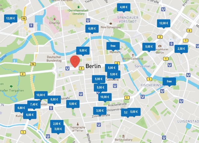
Casual needs apps leverage location intelligence to improve the everyday experiences of citizens. Local governments can develop apps that help residents find available parking spots, rent scooters, or even use intelligent shopping solutions. These apps not only enhance convenience but also reduce traffic congestion and wasted time.
By integrating location tool APIs, cities can create user-friendly solutions that boost citizen satisfaction and make urban living more efficient.
- Places API: enables users to easily find nearby services, such as available parking, scooter rental locations, and shopping centers, enhancing the overall convenience for citizens.
- Routing API: helps users find the fastest and most efficient routes, whether they are navigating to a parking spot, scooter station, or shopping area, saving time and reducing traffic congestion.
- Address Autocomplete API: simplifies the process of entering addresses in apps, providing real-time suggestions to users, making it quicker and easier to find specific locations.
Geoapify: Mapping Solutions and Tools for Smart Cities
Geoapify is an API platform that eases the process of building smart cities. We understand that cities have unique data needs, so we offer APIs that you can use as building blocks for custom solutions. Furthermore, our integration-friendly APIs are accessible through an intuitive, friendly design, making them a breeze to use.
You can try out the APIs with our Playground and think about what exciting ideas you can implement in your city. Or, if you already know what you want to achieve, you can register to start using the APIs for your start city app.
Don't know where to start from your smart city urban planning? Contact us, and let's talk about what you would want your city to look like for businesses and citizens!
How Much Does GIS or Mapping Software for Urban Planning Cost?
At Geoapify, we provide affordable GIS and mapping software solutions for urban planning, tailored to fit businesses of all sizes. As an API provider, our pricing is usage-based, meaning you only pay for what you use, making it flexible and scalable. Whether you're a small business or a large city project, we offer cost-effective solutions to meet your needs.
For more details, visit our Pricing Page, or or use our Price Calculator to estimate costs. Feel free to contact us for personalized pricing options or any questions you may have.
This version is concise and includes a link to the pricing page for more detailed information.
Explore More on Smart City Solutions and GIS Technology
Looking for more information on smart city solutions and GIS technology? Check out these helpful articles and resources:
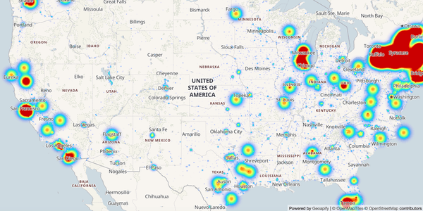
JavaScript Heatmap Example: A Step-by-Step Tutorial to Build Heatmaps with MapLibre GL
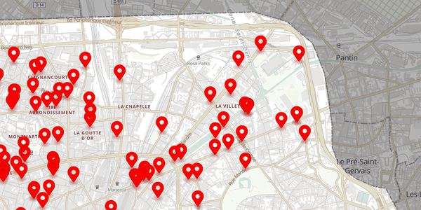
How to get OSM Places by category for a region
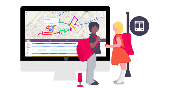
Bus route optimization with Route Planner API
FAQ
What is GIS software, and how is it used in smart cities?
GIS (Geographic Information System) software is used to capture, analyze, and visualize spatial and geographic data. In smart cities, it helps with urban planning, traffic management, and optimizing public services by providing real-time location-based insights.
How does mapping software improve smart city efficiency?
Mapping software enables cities to visualize data such as traffic patterns, infrastructure, and service areas. It helps city officials optimize routes, manage resources, and make data-driven decisions, resulting in reduced costs and better urban management.
What APIs does Geoapify offer for smart city solutions?
Geoapify provides APIs like the Map Tiles API for map visualization, the Routing API for route optimization, the Isochrone API for travel time analysis, and the Places API for finding nearby services. These tools enable efficient, real-time smart city applications.
How can location intelligence benefit citizens?
Location intelligence offers real-time updates on traffic, parking, public transport, and nearby services, allowing citizens to make informed decisions and navigate the city more efficiently, improving their daily experiences.
What is the cost of using Geoapify's GIS and mapping solutions?
Geoapify offers usage-based pricing, making it flexible and affordable for businesses of all sizes. You can visit the Pricing Page and use the Price Calculator to estimate your costs based on specific usage needs.
How can I get started with Geoapify’s APIs?
To get started, visit the Geoapify website, where you can explore our APIs and find detailed documentation. For personalized assistance, feel free to contact us directly.
