


Geographic Information Systems (GIS) is a technology that has revolutionized the way we understand and analyze our world. It provides a platform to store, manage, and analyze geospatial data to help make informed decisions in a variety of fields.
From urban planning to natural resource management, GIS has proven to be an indispensable tool in solving complex issues.
In this article, we'll take a closer look at why GIS is important and the 5 key benefits it offers. If you're looking to implement GIS into your workflow, Geoapify offers a variety of geospatial APIs and tools to get you started.
1. Understand and Visualize Geospatial Data
One of the key benefits of GIS is its ability to help us understand and visualize geospatial data. This data can be anything from demographic information to climate data, and it can be used to create maps and visual representations of complex information.
By visualizing this data in a geospatial context, GIS can provide us with a much clearer understanding of the relationships and patterns that exist in the world around us.
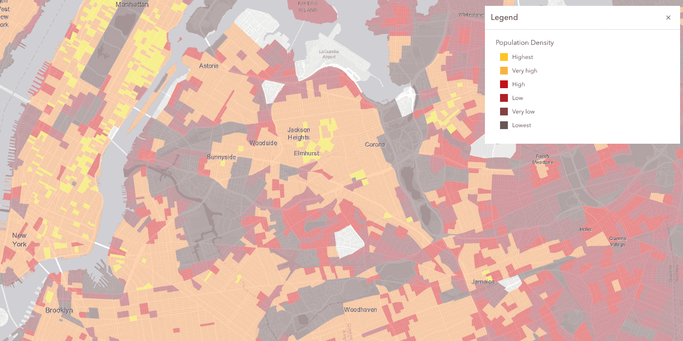
This map shows the most densely populated areas in the nation (above 30,000 persons per square kilometer).
For example, a GIS map of a city's population can show the distribution of people across the city and highlight areas with high or low population densities.
This information can then be used to make informed decisions about urban planning and infrastructure development.
2. Optimize Planning and Decision Making
GIS plays a critical role in the planning and decision-making process. By providing a platform to store and analyze large amounts of data,
It enables us to make informed decisions about a wide range of issues. This data can be used to identify trends, patterns, and relationships that would be difficult to see otherwise.
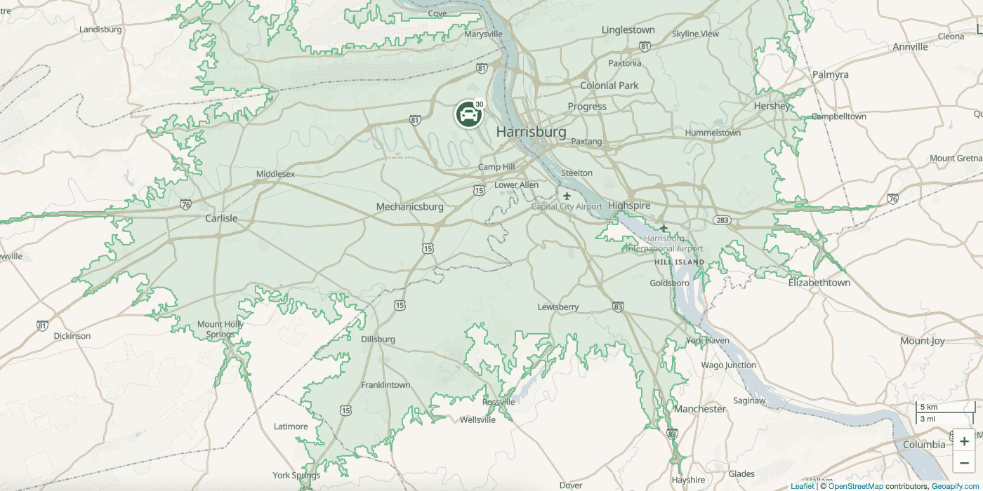
A reachability map shows how the reachability of a place can change by adding or blocking roads.
For example, GIS can be used to analyze the impact of proposed development projects on the environment and surrounding communities.
By analyzing data about the local ecology, topography, and population density, GIS can help planners make informed decisions that minimize the impact of these projects while maximizing the benefits to the community.
3. Enhance Emergency Response and Disaster Management
GIS is an essential tool in emergency response and disaster management. By providing real-time information about the location and extent of a disaster, GIS can help first responders quickly assess the situation and make informed decisions about the best course of action.
As an example, during a natural disaster such as a hurricane or earthquake, it can provide information about the affected areas, including the location of vulnerable populations, critical infrastructure, and potential evacuation routes.
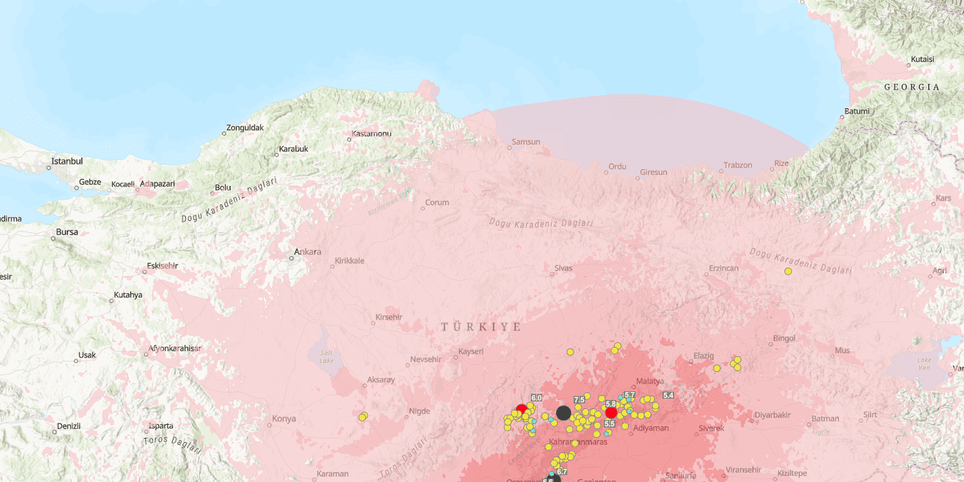
This map displays earthquakes by magnitude and also provides information about each earthquake's impact.
This information can then be used to coordinate a rapid and effective response.
Preparation is the cornerstone of minimizing risks and minimizing losses. Geoapify, a leader in geospatial analytics, empowers businesses to stay ahead of the game in disaster management and planning.
4. Improve Environmental Management
GIS has proven to be an indispensable tool in environmental management. By providing a platform to store, analyze, and visualize environmental data, GIS can help us understand the impact of human activities on the environment and make informed decisions to mitigate this impact.
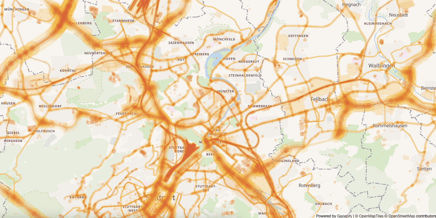
This map shows how noise pollution is affected by proximity to main roads, airports, and production objects.
It can be used to analyze the distribution and extent of deforestation, which is a major contributor to climate change. By tracking changes in forest cover over time, GIS can help us identify areas that are at risk of deforestation and take action to prevent it.
5. Enhance Business Operations and Marketing
GIS is not just for government and non-profit organizations. Businesses of all sizes can also benefit from the power of geospatial data and analysis.
By providing a platform to store and analyze customer data, GIS can help businesses make informed decisions about their operations and marketing strategies.
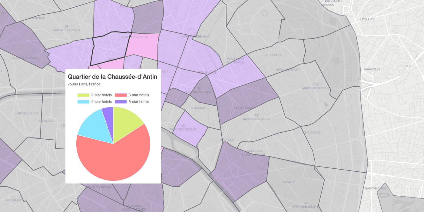
This map shows the geographical distribution of geo data by city districts.
A retail business can use GIS to analyze the demographics of its customers and identify the best locations for new stores.
By using geospatial data to understand the needs and preferences of its customers, the business can make informed decisions about its operations and improve its overall competitiveness.
Conclusion
In conclusion, GIS is a powerful technology that has transformed the way we understand and analyze the world around us. It enables us to store, manage, and analyze geospatial data to make informed decisions in a variety of fields.
With its ability to understand and visualize geospatial data, optimize planning and decision-making, enhance emergency response and disaster management, improve environmental management, and enhance business operations and marketing, GIS has proven to be an indispensable tool.
So, whether you're a government agency, a non-profit organization, or a business of any size, there are many benefits to be gained from using GIS to unlock the insights hidden in geospatial data. And, with Geoapify leading the way in geospatial analytics, the possibilities for innovation and progress are endless!