


Geoapify Open Geospatial Program
Geoapify Open Geospatial Program is a community initiative for developers, students, data analysts, and technical creators building practical geospatial projects with Geoapify APIs.
Selected projects receive sponsorship, extended API access, and promotion through Geoapify channels.
On this page
Program Summary
Geoapify Open Geospatial Program supports practical open projects that developers can run, learn from, and reuse. The goal is to publish real working solutions built with Geoapify APIs, together with clear implementation guidance.
Examples of projects:
- An interactive store locator with category filters and nearby place search.
- A geocoding + autocomplete workflow for address validation and standardized results.
- A CSV-to-map visualization tool for city analytics or public data exploration.
- A step-by-step MapLibre GL or Leaflet tutorial with runnable source code.
See Project Requirements for the exact project format.
Batch #1 - Maps & Places
- Status: Applications Open
- Application deadline: June 10, 2026, 23:59 UTC. See how to apply.
- Rewards include EUR 300 sponsorship for selected completed projects plus bonus opportunities. See reward details.
After the deadline, we review all applications and notify every applicant whether the project is selected or not selected for Batch #1.
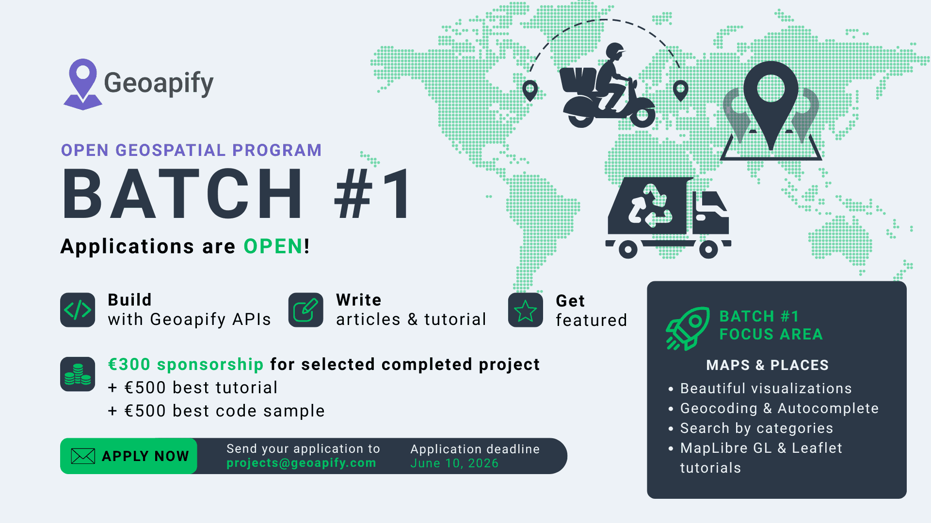
Batch #1 is focused on building practical "maps and places" products that other developers can reuse and learn from. Good projects usually combine searchable location data, map rendering, and a clear user flow such as discovery, lookup, filtering, or visualization.
Relevant APIs for Batch #1 include Map Tiles, Geocoding API, Reverse Geocoding API, Map Marker Icons API, Places API, Place Details API, and Boundaries API. You can also combine related APIs such as Address Autocomplete and Static Maps API when they improve the final workflow.
Example project ideas:
- A city coffee guide with category filters, nearby search, and custom map markers.
- A geocoding QA tool that compares input addresses with normalized geocoding results and reverse-lookup validation.
- A neighborhood explorer that combines Places + Place Details + Boundaries for local discovery pages.
- A CSV-to-map dashboard that visualizes branch locations with searchable metadata and static map previews.
- A geospatial data scraper/enricher that collects places by category and exports structured datasets.
- A map image generator that produces shareable static maps with custom markers, styles, and labels.
- A MapLibre, Leaflet, or OpenLayers tutorial with a runnable demo and step-by-step implementation notes.
- A fun or experimental map project (for example, thematic "funny maps" with playful categories, local trivia, or unusual place collections).
- Your own idea: if your project is practical, public, and built with Geoapify APIs, we want to see it.
What Participants Receive
Selected participants receive:
- EUR 300 sponsorship upon successful project completion.
- EUR 500 bonus per batch for the best tutorial/article.
- EUR 500 bonus per batch for the best code sample/demo.
- Extended Geoapify API access for project development and testing.
- Promotion through Geoapify channels (website, social, and community highlights).
Notes:
- Payments are made via PayPal and may depend on regional availability and legal eligibility.
- All rewards and participation conditions are defined in Program Terms.
How to Apply for Batch #1
- Send an email to [email protected].
- Copy the template below, fill it in, and include it in your email.
- Submit your email before the batch deadline.
Here is the email template:
Subject: Geoapify Open Geospatial Program - Batch #1 Application

1. Who are you?
- Name:
- Role (developer / student / analyst / creator):
- Country / timezone:

2. Project overview
- Project title:
- One-sentence summary:
- What problem are you solving?

3. Links (existing resources)
- Your GitHub repository:
- Portfolio / blog / profile:
- Other:

4. Geoapify implementation
- Which Geoapify APIs will you use?
- Why these APIs?

5. Deliverables
- Where will the code be published?
- Where will the tutorial/article be published?
- Where will the live demo run?

6. Timeline
- Planned start date:
- Planned completion date:

7. Payment availability
- Can you receive PayPal payments in your country? (Yes/No)
- If no, which payout method can you receive?

8. Additional notes
- Anything else we should know?
Project Requirements
All projects should include open code, a runnable demo, and a tutorial article.
To be eligible for review, your project must include all of the following components:
API key note: Demos should be runnable for everyone, so they must include a published API key. Geoapify will provide an API key for selected projects. Private API keys must not be committed to public repositories.
Submission result template:
Subject: Geoapify Open Geospatial Program - Batch #1 Final Submission

1. Project title and description
- Title:
- Description:

2. Final deliverables
- Public code repository URL:
- Setup and run instructions:
- Live demo URL:
- Tutorial/article URL:

3. Geoapify API usage
- APIs used:
- Short summary of implementation:

4. Release information
- License:
- Version / tag / commit hash:

5. Notes
- Known limitations (if any):
- Anything else to review:
Quality assurance and code quality
Projects should be understandable, reproducible, and safe to run.
Learn more about review handling in Submission review and fix policy.
- The demo should work without manual fixes.
- The repository should include clear setup/run steps.
- Core flows should be tested (manual test checklist or automated tests).
- Code should be readable and structured for reuse.
- Dependencies and build steps should be documented.
- Known limitations and edge cases should be listed.
- Broken links, non-working demos, or missing setup instructions may disqualify the project from rewards.
Program Terms
These terms define how submissions are reviewed, how rewards are granted, and how participation is handled.
Submission review and fix policy
- Every final submission is reviewed for functionality, completeness, and documentation quality.
- If issues are found (for example: broken demo, non-working links, missing setup steps, or incorrect API usage), Geoapify may request revisions.
- Each project includes one formal fix round after review.
- Standard fix window is up to 7 calendar days after feedback, unless another deadline is explicitly provided.
- Additional fix rounds may be granted at Geoapify's discretion, but are not guaranteed.
- If fixes are delivered on time and requirements are met, the project remains eligible for sponsorship and bonuses.
- If critical issues are not fixed by the deadline, or if there is no response, the project may be marked as not completed and become ineligible for payout.
- Geoapify may run a final verification pass after fixes are submitted.
Rewards and content usage
- Sponsorship and bonuses are awarded only after final review of deliverables.
- Approved sponsorship and bonus payments are issued within 15 calendar days after final review approval.
- Bonus awards are based on quality, clarity, and practical usefulness.
- Participants keep authorship of their code and content.
- Geoapify may reference, copy, and showcase selected project code with attribution.
- Geoapify may republish or adapt submitted tutorials/articles with attribution to the original author.
Legal and operational terms
- Project selection is competitive and made at Geoapify's sole discretion.
- Geoapify may update timelines, rewards, or batch scope; updates will be published on this page.
- Projects may be disqualified for plagiarism, fraud, license violations, illegal content, non-public deliverables, or non-response during review.
- By applying, participants confirm they have the rights to publish all submitted code, content, and assets.
- Application data is used for program operations; selected projects and participant names may be publicly announced.
- Participants are responsible for any taxes, reporting, or local obligations related to received payments.
- Participation does not create an employment, agency, or partnership relationship with Geoapify.
Payment and eligibility
- Rewards are paid via PayPal by default.
- If PayPal is unavailable in your country, an alternative payout method may be considered at Geoapify's discretion.
- Payments may be restricted by applicable laws and compliance requirements (including EU sanctions and OFAC sanctions programs), or by PayPal country/feature availability.
- This may include sanctioned jurisdictions and sanctioned individuals/entities.
- Final payout eligibility is verified at payout time.
FAQ
Who can apply?
Developers, students, data analysts, and technical creators can apply if the project matches the Project Requirements.
Can individuals and teams both apply?
Yes. Individuals and teams are both welcome. Use one application email and clearly identify the main contact person in How to Apply.
Do I need to use a specific programming language or framework?
No. You can use any language or framework if the final project is public, runnable, and documented.
Do I need to use specific Geoapify APIs?
Use the Geoapify APIs that best match your project goals. You are not required to use a fixed API set. Browse options on the Maps API overview page.
Can I submit an existing project, or must it be new?
Both are possible. You can submit an existing project if it has not participated in this program before and it meets all Project Requirements.
What makes a project eligible for rewards?
Rewards depend on final review quality and completion criteria described in What Participants Receive and Program Terms.
What happens if my final submission has issues?
Geoapify may send a fix request if there are issues such as non-working links or missing setup steps. See Submission review and fix policy.
Will I get a chance to fix issues after review?
Yes. Each project includes one formal fix round. Timing and conditions are described in Submission review and fix policy.
How and when are rewards paid?
Rewards are paid after final review and completion approval. Details are in What Participants Receive and Program Terms.
Do I need PayPal, and what if it is not available in my country?
PayPal is the default payout method. If PayPal is unavailable, tell us in your application. Eligibility still depends on legal/compliance checks. See Program Terms.
Who owns the code and tutorial after submission?
Participants keep authorship of their code and content. See Program Terms.
Can Geoapify reuse my code or republish my tutorial?
Yes, Geoapify may reference, showcase, copy, or adapt submitted code/tutorials with attribution, as described in Program Terms.
Who is responsible for taxes related to rewards?
Participants are responsible for their own taxes and local reporting obligations. See Program Terms.
How many projects are selected per batch?
The number is not fixed and depends on submission quality and available program capacity. Selection is competitive and discretionary. See Program Terms.
Where can I ask questions before applying?
Send your questions to [email protected] before submitting your application.


