


The comparison between vector tiles and raster tiles is becoming increasingly relevant in the world of digital mapping.
Are raster maps outdated and old-fashioned? Are vector tiles the new trend shaping the future of map rendering?
In this article, we’ll explore:
- What map tiles are;
- The differences between raster and vector tiles;
- The pros and cons of each approach.
What Are Map Tiles?
Map tiles are the building blocks of a digital map. They represent various map elements such as streets, rivers, parks, and other features.
These tiles form the base layer of a map and define how it looks — its style, structure, and type.
Tiles are generated based on GIS data, rendered by a map provider’s server, and delivered to client applications on demand. This allows applications to display the map seamlessly by assembling and visualizing these tiles.
If you want to try rendering your own maps, check out Geoapify’s Map Tiles API.
The Shift: From Raster to Vector
Until recently, all map tiles were raster-based. However, as the digital mapping market grows and technology evolves, more map providers — including Geoapify — are now offering vector tiles alongside raster tiles.
Today, we have a choice: Raster tiles vs Vector tiles.
But which one should you choose?
Each format has its own advantages, disadvantages, and implementation specifics. In the following sections, we’ll break them down to help you make an informed decision.
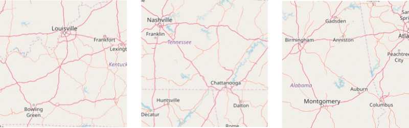
Raster Map Tiles
Raster map tiles are images by nature of size optimized for the web. Below you can see examples of raster tiles. Map frameworks and SDKs place raster map tiles in the correct order to generate a map as a result.
Pros
- It's proven by time technology, which works on all types of devices (desktop and mobile) and all browsers.
- Rendered on a server, raster map tiles do not create performance load on client site.
Cons
- There is no way to customize or add new styles on the client site.
- Not possible to change labels, show/hide objects in the client application.
- During some moment you can see empty areas on the screen on map move/zoom. That is to say, it takes some time until the required tiles are loaded.
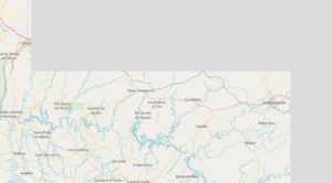
Vector Map Tiles
In comparison to raster tiles, vector tiles are not images, but binary files. They contain all the required information to generate a map on the client side.
Pros
- Map and labels style can be changed in client application on a fly. Check our tutorial on How to customize vector maps by adding new layers and How to change colors and labels on a vector map.
- Tiles have a very small size, which makes them ideal for streaming and offline maps.
- The map is moved, zoomed in/out smoothly without rendering delays.
Cons
- Rendering happens on the client side, which could create performance problems on slow devices.
- Not all SDKs for vector maps have a mobile version yet. It happens that visualization is not correct or too slow on some devices.
- There is no standard, not binding you to a map provider SDKs yet.
Vector vs Raster Map Tiles: What to Use?
So what to use? It depends on the needs of your application. We would recommend you to go to vector tiles direction if the size of map tiles and styling flexibility is important for your application. And stay with raster version of maps if maps should work on any types of devices, including slow one.
To help you decide, here are some example use cases and benefits:
Why Use Vector Tiles
- Better / Smoother Zooming – Ideal for apps where users frequently zoom in and out (e.g., navigation or tourism apps).
- Faster – Smaller file sizes enable quicker loading and better performance over networks.
- Ability to Deliver 3D Maps – Vector data supports 3D buildings, terrain models, and more interactive layers.
- Easily Customizable – You can change styles, colors, and even visibility of layers on the fly without requesting new tiles.
Why Use Raster Tiles
- Broad Compatibility – Great choice for legacy systems and older browsers or devices.
- Static Map Generation – Useful for printing maps or generating fixed images for reports and offline materials.
- Simpler Setup – Easier to implement in simple applications where dynamic styling isn't needed.
Geoapify Provides Raster and Vector Map Tiles in Multiple Styles
Geoapify provides both raster and vector map tiles to support a wide variety of applications — from fast-loading web apps to highly interactive mobile tools. Whether you're building a travel planner, fleet tracker, city guide, or static map for a brochure, we’ve got you covered.
You can choose from a range of map styles, including light, dark, terrain, and retro. For static visuals, our Static Maps API generates map images that can be embedded or exported. If you need complete design control, vector tiles allow you to build your own look with layers, color changes, and custom label styling.
- Raster map tiles for universal compatibility
- Static Maps API for printable images and reports
- Vector customization tutorials and label/color styling guides
Start for free and upgrade as your usage grows — Geoapify’s plans are designed to scale with your project.
FAQ
What are vector maps used for?
Vector maps are used in dynamic applications where interaction and customization matter. Common examples include delivery tracking apps, location-based services, and smart city platforms.
How to tell if a map is raster or vector?
Raster maps often appear blurry or pixelated when zoomed in. Vector maps remain crisp and allow on-the-fly styling like label color or font changes.
Is a topographic map a raster or vector?
It can be either. Scanned topographic maps are raster, but modern GIS platforms provide vector-based topographic layers with adjustable styling.
Which is faster, raster or vector?
Vector tiles usually load faster and more smoothly on modern devices. Raster tiles may load more quickly on older or limited-performance devices due to server-side rendering.
Difference between raster and vector in GIS?
Raster represents continuous data (like elevation or heatmaps), while vector represents structured data (roads, zones, POIs). Learn more about geospatial data types →