Category: Maps API

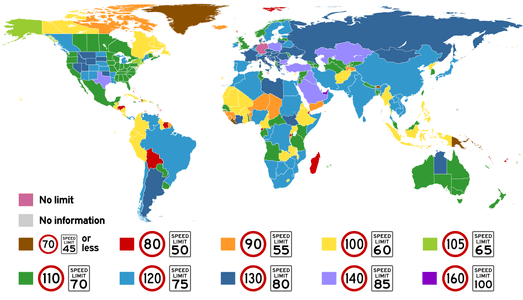
Highest posted speed limits around the world. The <a href="https://commons.wikimedia.org/wiki/File:World_Speed_Limits.svg" rel="nofollow" target="_blank">original image</a> is licensed under <a rel="nofollow" target="_blank" href="https://creativecommons.org/licenses/by-sa/4.0/">CC BY-SA 4.0</a>.
Maps API

Country Speed Limits: Tailoring Global Delivery Routes

Explore global speed limits and adapt your vehicle routes to global speed regulations with our Route Optimization APIs...
Read More
Using Routing API for trucks to solve logistics tasks efficiently
Maps API

Truck Routing: Unleashing the Potential of the Routing API

Get accurate specialized trucking routes with Geoapify's Truck Routing API. Make sure your cargo arrives safely and on schedule while keeping costs down....
Read More
JavaScript developers can leverage user location data to create dynamic web apps that adjust map views, show nearby points of interest, and offer personalized recommendations
Maps API

How to Get User Location with JavaScript: A Comprehensive Guide

Get visitor location on your website with JavaScript. Explore methods like navigator.geolocation, IP geolocation, and more with practical examples...
Read More
Geolocation technology has many benefits for users, but also some risks
Maps APIUse casesSolutions

What is Geolocation: How It Works and Its Many Uses

Learn how geolocation technology works, its uses, and the benefits and risks of collecting user location data. Explore its applications and learn the best practices....
Read More
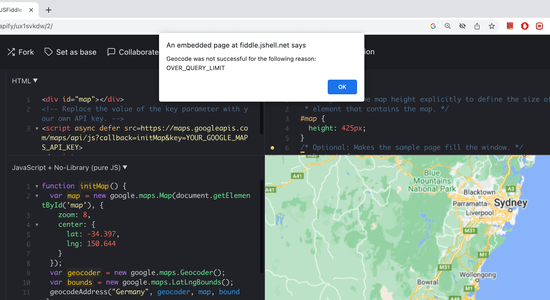
JSFiddle shows OVER_QUERY_LIMIT geocode error
Maps API

Overcoming Geocoding Limits: How to Manage the OVER_QUERY_LIMIT Status

Learn how to handle 'OVER_QUERY_LIMIT' status in the Google Geocoding API. Our tips and strategies will help you troubleshoot geocoding issues...
Read More
Geobatchpy package connects Geoapify with Python
Maps API

How to integrate Geoapify into your Python data science toolbox

Learn how to prepare your addresses for geospatial analytics. Our tutorial covers the API, GeoJSON, and GeoPandas and how these pieces fit together...
Read More