


Travel time is one of the most important criteria when you choose a location. That's why a travel time map or isochrone is often used as the main analytics tool to answer spatial questions. In this article, we would like to show you some scenarios of how travel time maps can help to make a location decision.
Travel time map use cases for businesses
While Location Intelligence becomes one of the key tools of Business Intelligence travel time maps become more and more popular in the business world. Here are a few examples of the isochrones application which could solve business tasks.
Choose a new office location
Relocation is always a big step for a company. It's important not only to satisfy the needs of the existing employees but also choose an attractive location for the new employees.
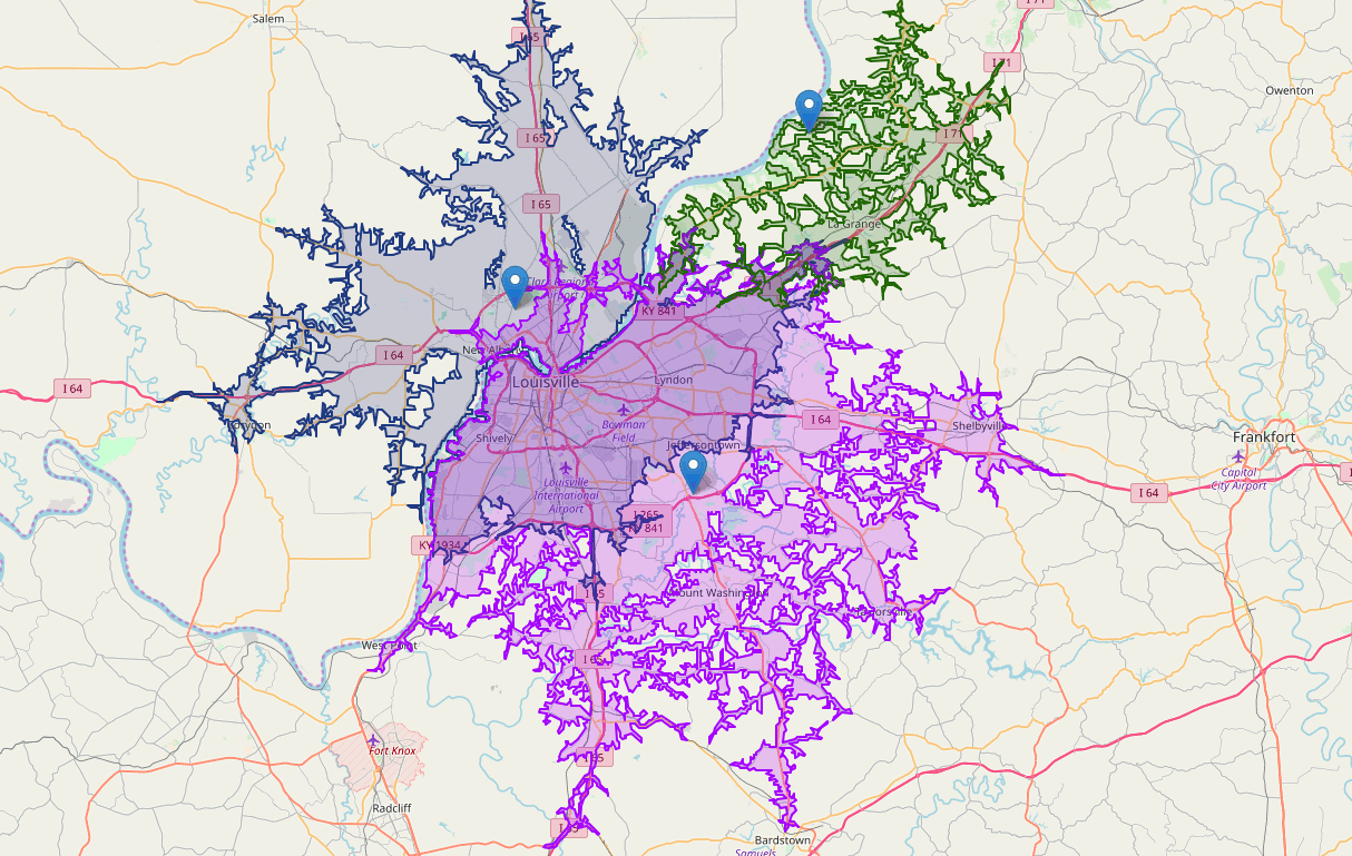
You can build reachability maps with desired time for each of your current employees and check if there is an intersection between them. Moreover, with isochrones, you can filter statistics and check how many potential workers are living in the bounded area of a new office.
Check coverage of your network
You can build isochrones for each of your selling points and check their union to see the coverage of your network. Different transportation modes, for example, "by public transport", "driving", or "walking", help you to see if there are empty spots on your coverage map.
Choose the best place for a new retail shop
Not only vacant spots but also potentially profitable locations could be found with Location Intelligence tools and isochrones. For example, you can see if your target auditory can reach a new location easily. Moreover, you can filter properties by isoline and check exact numbers for the location.
Estimate a place reachability
It's always good to rank locations by reachability. How good is the public transport connection for a place? How big reachability area by car? Better connectivity will always provide more potential and perspectives for a location. In short, travel time maps are designed to solve this task as well.
Read our guide on how to build Travel Time Maps for Public Transport.
Study opportunities and potential of a location
When you have statistical data, for example, demographic data, you can bound the data by travel time maps and get statistics by isochrones. So you can study opportunities and potential clients, who can reach the location within the desired amount of time.
Travel time map use cases for individuals
Not only businesses but also individuals can benefit using isochrones. Thus if you provide the service on your website, the website becomes more valuable and attractive for your customers.
Optimize commute time by choosing the right place to live
It's know fact, that fewer time people spend commuting, happier they are. Isochrones can help you to optimize commute time for each family member to their working or study place. If you build the travel time maps and then calculate the intersection of them, you can see locations reachable from each point of interests.
Optimize commute time by choosing the right place to work
Moreover, the inverse problem also could be solved with isochrones. If you plan to change your working place, the travel time map could show you all the possible areas where a new working place could be.
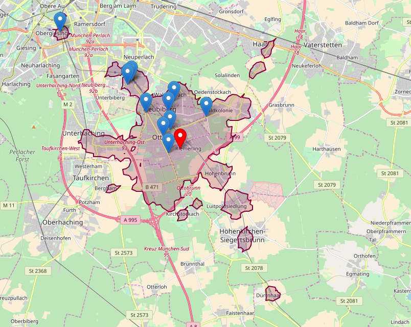
Study amenities you can reach
Would you like to see on the map only amenities you can reach within the desired time? Sure, it would be great! Filtering amenities by an isochrone provides you the answer.
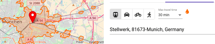
Choose the best place to stay in a new city
When you plan a trip to a city you've never visited before it always a challenge to book accommodation in a good location. Often you need a good transport connection to multiple points of interest. For example, to the airport and conference place. Intersection on travel time maps of each of the locations will show you the perfect place for accommodation.
Book a hotel within desired travel time from seaside or ski resort
Isolines will also help you to book a hotel within walking or driving distance from seaside or ski resort. By calculating union of beach entries or ski lifts reachability maps, you can see on a map where hotels with an acceptable walking or drive time are.
Geoapify provides Isoline API to build travel time maps
Isochrone API allows you to build travel time maps for different traveling modes and all over the world. Our APIs work via HTTP Get requests and return GeoJSON object as a result. Moreover, we provide Geometry API which calculates intersections and unions of isochrones. So you can quickly and with ease create your own Location Intelligence solution or extend an existing one. Register and start building isochrones for free.