


In today’s digital landscape, providing users with accurate and relevant location search results is crucial for enhancing user experience and engagement. Effective location search not only improves user satisfaction but also increases the utility of applications that rely on geographic data.
By leveraging advanced querying methods and robust APIs, developers can significantly enhance the precision of location searches. One such powerful tool is the Geoapify Places API, which offers versatile features to improve the relevance of search results.
Ways to Query Points of Interest
By Bounding Box
The bounding box method retrieves POIs within a defined rectangular area. This technique is particularly effective for applications requiring map-based searches.
By Radius Map
Radius map searches find POIs within a specified radius around a point. This is useful for localized searches where users are interested in nearby amenities.
By Travel Time Map
Travel time maps provide POIs based on the area that can be reached within a certain time frame. This method is ideal for users who prioritize accessibility and convenience.
Geoapify offers a comprehensive Places API that allows location searches by bounding box, radius, and travel time maps (isoline). This API supports a wide range of amenity types, continually expanding with new additions. Read more about Geoapify Places API.
Location Search by Bounding Box
The bounding box search method ensures efficient retrieval of POIs within a user-defined geographic area, enhancing the user experience in map applications by providing relevant search results.
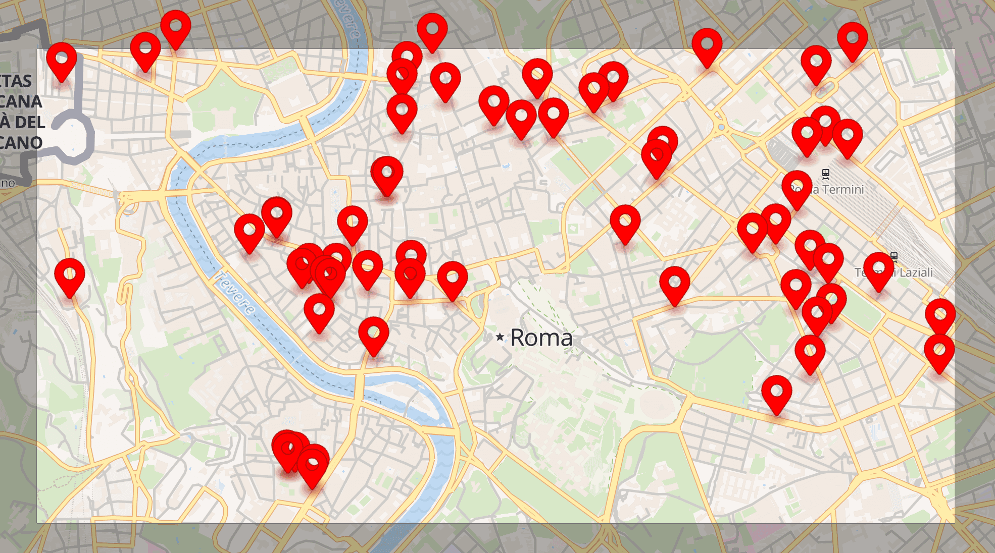
When there is no specific starting point for the search, such as a home address or exhibition location, it is necessary to display points of interest (POIs) across the entire visible area of the map. This typically involves querying data within a bounding box that matches the map's viewport. Key implementation details include:
- Executing a new query with each map movement to load new POIs.
- Defining a minimal zoom level to avoid overwhelming the map with too many POIs at larger scales (e.g., city or country level).
- Using custom marker pins to enhance map informativeness. Read more about custom marker items.
Location Search by Radius Map
Radius-based searches locate POIs within a certain distance from a central point. This approach is excellent for finding amenities and services near a specific location, making it particularly useful for users looking for nearby options.
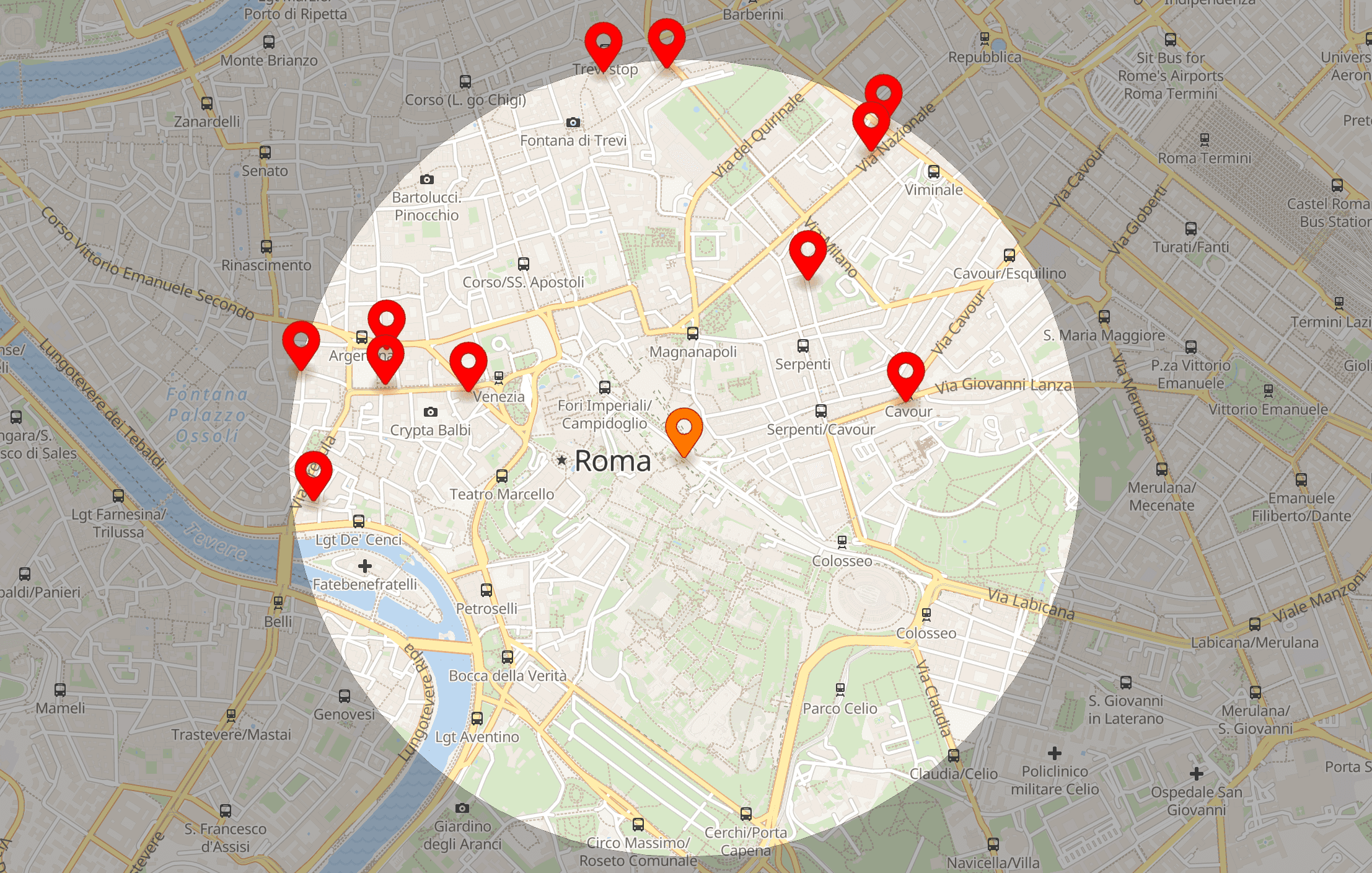
For example, a radius search can help find restaurants, gas stations, or ATMs within a 1000-m radius of the user’s current location. This method is advantageous for applications that need to provide users with quick access to nearby services.
Location Search by Travel Time Map
Travel time-based searches offer precise results by considering actual travel conditions. This improves the relevance of the search results for users looking for accessible locations based on their travel preferences.
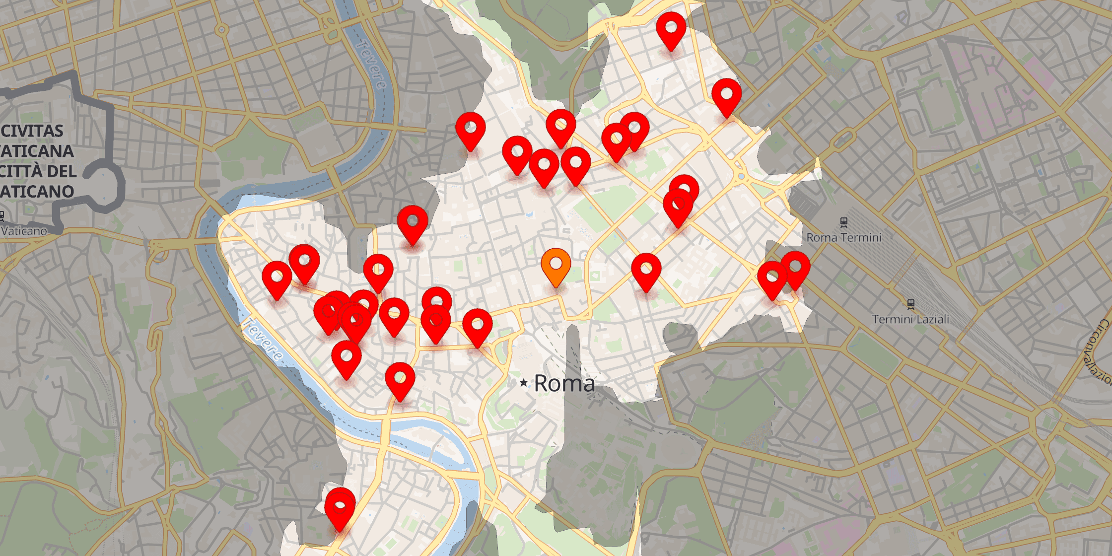
Travel time maps, or isochrones, depict areas reachable within a specified time from a location. For instance, they can show all areas within a 20-minute drive from home or within 30 minutes by public transport from a conference venue. Isochrones act as filters for locations accessible within the desired timeframe, displaying only relevant data for users. Implementation benefits include:
- Performing a query only once per location, transportation mode, and time value.
- Data quantity depends on the isochrone size, not the map zoom level.
These features ensure a realistic and user-centric map display.
Places API from Geoapify
Geoapify’s Places API offers powerful tools for querying POIs using bounding boxes, radii, and travel times. This API supports a wide range of amenity types, continually expanding with new additions.