


Location Intelligence APIs and Solutions For Your Business
Looking for a place to live, a new office or preparing for vacations? Then a good location is one of the most important components of a good choice! Is it simple to find a good location, that fits all your search criteria? Hmm... Not really! However, location intelligence and analytics will definitely help you to solve the task!
Geoapify offers location intelligence APIs, algorithms, and services to solve your business tasks in the most effective way. Contact us and we will be happy to help you!
Location Intelligence API Use Cases
Property Search in Real Estate
Geoapify’s location services streamline the property search in Real Estate by optimizing key factors:
- Commute Time and Price: Find properties that offer the best combination of affordability and convenient commute times.
- Proximity to Amenities: Locate properties near essential services like schools, hospitals, and public transport.
- Neighborhood Insights: Access detailed maps with information on safety, demographics, and future developments.
- Interactive Maps: Explore properties with detailed descriptions, photos, and virtual tours for an immersive search experience.
Geoapify makes finding the perfect property easier and more efficient.
Find a Place to Stay or Visit in Travel & Tourism
Geoapify’s location intelligence solutions enhance the travel and tourism experience by helping users find the best places to stay and visit:
- Accommodation Search: Locate hotels, hostels, and vacation rentals that match your preferences, including proximity to attractions, price range, and amenities.
- Tourist Attractions: Discover popular tourist spots, historical sites, and hidden gems tailored to your interests.
- Itinerary Planning: Create optimized travel itineraries with recommendations for dining, shopping, and activities based on your location and preferences.
- Accessibility Information: Access details on public transportation, walkability, and travel times to ensure a smooth and enjoyable trip.
- Local Insights: Gain insights into the local culture, events, and safety information to make informed decisions during your travels.
Geoapify's tools make travel planning effortless, providing comprehensive information to ensure a memorable and well-organized trip.
Analyze Locations to Identify Promising Ones in Marketing
Geoapify’s location services empower marketing professionals to make data-driven decisions by analyzing various factors to identify promising locations:
- Demographic Analysis: Understand the demographics of different areas to target the right audience with tailored marketing campaigns.
- Market Potential: Evaluate market potential by analyzing foot traffic, nearby businesses, and consumer behavior patterns.
- Competitor Insights: Gain insights into competitor locations and their impact on market share, helping to strategize and optimize your own placements.
- Customer Accessibility: Identify locations that offer easy accessibility for your target customers, enhancing the effectiveness of your marketing efforts.
- Geo-targeted Campaigns: Create geo-targeted marketing campaigns that resonate with local audiences, increasing engagement and conversion rates.
Geoapify provides the tools needed to analyze and select the best locations for your marketing initiatives, ensuring you reach the right audience in the most effective way.
Analysis of Access to Facilities in Health Care & Social Assistance
Geoapify’s location intelligence solutions provide valuable insights for optimizing access to health care and social assistance facilities:
- Facility Accessibility: Evaluate the accessibility of hospitals, clinics, and social services for different populations, ensuring that essential services are within reach.
- Service Area Mapping: Create service area maps to identify regions that are underserved and require additional facilities or services.
- Travel Time Analysis: Analyze travel times to health care facilities using various modes of transportation, helping to improve patient access and reduce delays.
- Emergency Response Planning: Optimize the placement of emergency response units and resources to ensure timely assistance in critical situations.
Geoapify's tools enable health care and social assistance providers to enhance service delivery by ensuring facilities are strategically located for maximum accessibility and impact.
Find Answers on a Map in Other Industries
Geoapify’s versatile location platform can be applied to a wide range of industries, providing valuable insights and solutions:
- Retail: Identify optimal store locations based on consumer demographics, foot traffic, and competitor analysis.
- Logistics: Optimize supply chain routes and warehouse placements for efficient distribution and cost savings.
- Education: Map school districts, analyze student distribution, and plan for new educational facilities.
- Environmental Management: Monitor environmental changes, manage natural resources, and plan conservation efforts with detailed geographic data.
- Public Safety: Improve emergency response planning, crime mapping, and resource allocation to enhance community safety.
Geoapify’s APIs empower various industries to leverage location intelligence, making informed decisions and optimizing operations with spatial data insights.
Location intelligence helps to find a place to live in a big city
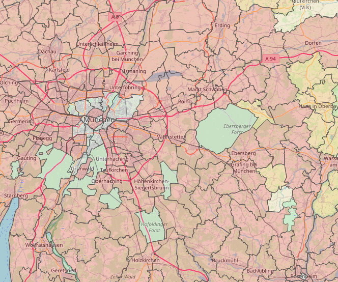
A great example of a location intelligence solution for property search in a big city. We combine property prices information with reachability maps to find underrated and hidden spots. A travel time map from the Central Train Station (Hauptbahnhof) and Ost Train Station (Ostbahnhof) show you areas reachable from them within 60 minutes.
Information about big P+R areas and drive time maps from them cover Park and Ride case and show you possible areas to live if you are ready to drive 5-10 min to the nearest public transport station.
Location Intelligence API Pricing
Geoapify uses a credit-based system for pricing its Location Intelligence API, which enables advanced geospatial analytics and data visualization. The number of credits consumed depends on the specific API operations performed, such as geocoding, reverse geocoding, or route optimization.
- One credit is consumed for each standard API request made through the Location Intelligence API.
To cater to different user needs, Geoapify offers a range of pricing plans with varying credit allowances and additional features. For more details, visit our Pricing page.
If you're just getting started, our Free Plan includes 3000 credits per day, perfect for experimenting with the Location Intelligence API or conducting small-scale projects at no cost.
Examples of Credit Usage:
- Example 1: Performing 100 geocoding requests will consume 100 credits (1 credit per request).
- Example 2: Executing 250 reverse geocoding operations will use 250 credits (1 credit per operation).
- Example 3: Calculating 500 optimized routes requires 500 credits (1 credit per route).
This flexible credit system ensures that the Location Intelligence API is accessible for a variety of applications, from basic tasks to complex, large-scale projects.
FAQ
What is the Geoapify Location Intelligence API, and how does it help with place search?
The Geoapify Location Intelligence API provides advanced geospatial tools to search, filter, and analyze locations. It helps businesses and developers create place search functionalities based on proximity, categories, and custom criteria.
Can I search for places using custom filters or specific categories?
Yes, our API supports searching for places using custom filters, including categories, tags, or even geographic constraints like polygons. This makes it easy to tailor place search results to your unique requirements.
Is the Location Intelligence API compatible with multiple data sources?
Our API primarily uses OpenStreetMap data and other open data sources. However, you can combine it with your private datasets by overlaying them on the maps or integrating them into search queries.
Does the API support multi-language queries for place search?
Yes, the API can handle place searches in multiple languages. Results are provided in the specified language whenever supported by the underlying data sources.
What is the response time for place search queries?
The typical response time is under 300 milliseconds for standard queries. For complex searches with multiple filters, response times may vary but remain optimized for performance.
Is the API suitable for high-traffic applications?
Absolutely! Our Location Intelligence API supports high-volume usage with scalable plans and optional dedicated endpoints to handle heavy traffic seamlessly.
Are there any limits to the number of places returned in a single query?
Yes, the default limit is 100 places per query to ensure fast response times. You can request adjustments if needed for your specific use case.
Is the API GDPR-compliant, and where are your servers located?
Yes, the Geoapify Location Intelligence API is fully GDPR-compliant. By default, our services use European servers, but dedicated endpoints in other regions can be set up upon request.
Can I store and reuse the place search results?
Yes, since our services rely on Open Data, you are free to store the results. However, it is important to include proper attributions to the data sources in your application.
What pricing plans are available for the Location Intelligence API?
We offer flexible pricing plans to suit different needs, from free usage for small-scale applications to enterprise solutions for large-scale operations. Visit our [Pricing page](https://www.geoapify.com/pricing/) for more details.
Location intelligence components
Statistics
Statistical data visualized on a map already brings a lot of value. Moreover, when we combine and operate with a few parameters it can show you locations you never thought about.
Travel time analysis
How far can you go from a location? How big is a reachability area of a place? What does the reachability area contain? And answers to other questions that help to understand a place location.
Places information
Information about places, amenities, and points of interest helps to recognize search starting positions and filter places.


