


The importance of available open data plays a big role in developing geospatial and location analytics applications. Copernicus is the European Earth Observation and Monitoring Programme. It provides open GIS data and information to help better understand our planet.
Copernicus database is built with the help of thousands of air-, land- and marine-based sensors, which currently produce and collect more than 12 TB of data per day.
Copernicus open data services - https://www.copernicus.eu
What could you find in Copernicus open GIS data services?
Copernicus services deliver GIS data to allow efficiently manage natural resources, control the quality of air and water, plan cities construction, and optimize usage of agricultural lands.
At the moment Copernicus program offers open GIS data in 6 domains:
- Atmosphere
- Marine
- Land
- Climate Change
- Security
- Emergency
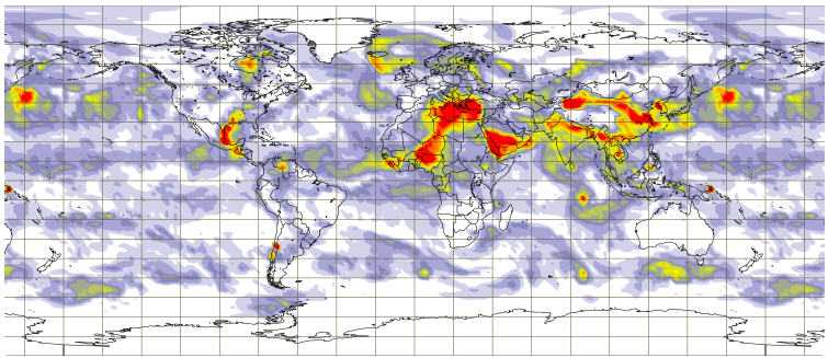
Copernicus Atmosphere
Atmosphere service produces and provides continuous data on atmospheric composition (Ozone, CO2, UV index and so on). Moreover, it allows to create the current situation analysis and make forecasts.
For example, atmospheric composition, air quality, ultra-violet & solar radiation, surface fluxes & emissions, climate forcing are the main focus of the service.
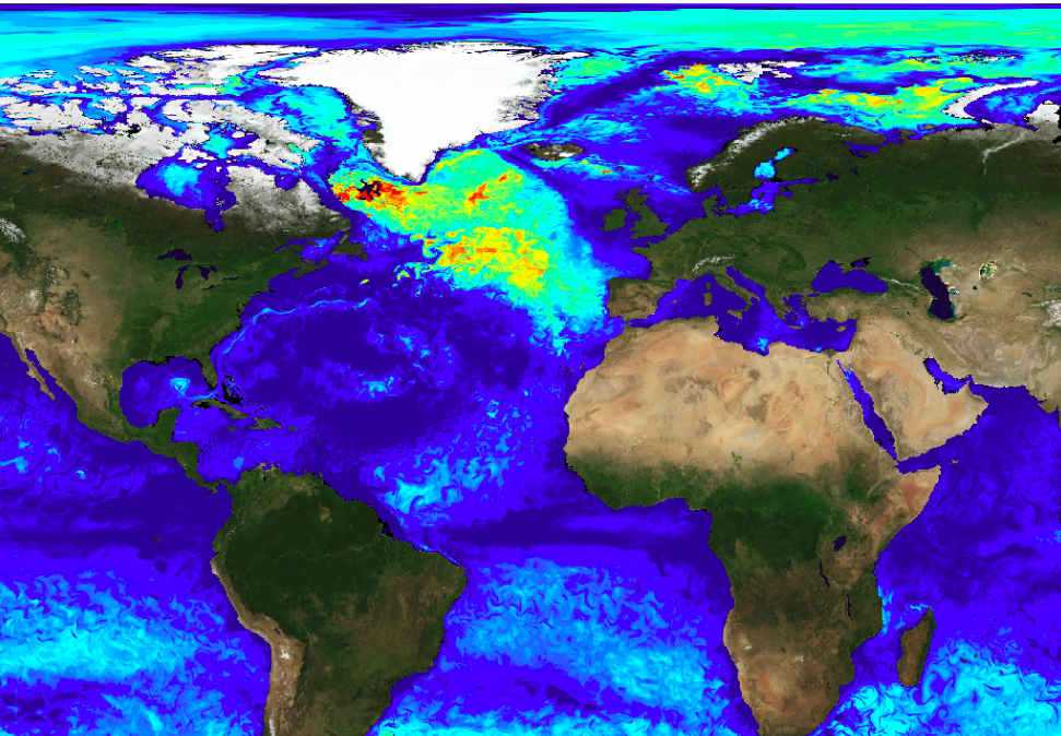
Copernicus Marine
Marine service offers open data on the biochemical and physical state, variability and dynamics of the global ocean and the European regional seas. So information about the coastal & marine environment, marine safety, resources data, as well as weather forecasts and climate observations you can find here.
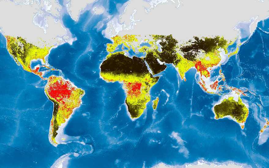
Copernicus Land
Copernicus Land service provides geographical GIS data on land cover, land use & vegetation, state & changes, water cycles, and earth surface energy information. You will find the GIS data required for cities planning, forests & water management, agricultural & rural development applications. Moreover, the service offers data about the adaption of the ecosystem on climate changes.
Copernicus Climate Change
Climate change forecast as well as information of the current situation you can find in the Copernicus Climate Change service. For instance, surface temperature, greenhouse gases, sea ice & sea level, glaciers states, and other headline climate indicators.
Copernicus Security
The main focus of Copernicus security services is crisis prevention, preparedness and response in three key areas: border surveillance, maritime surveillance, support to EU External Action. The service provides earth observation materials, as well as training how to obtain and use them.
Copernicus Emergency
Copernicus Emergency service offers data required for building solutions on the management of natural disasters, man-made emergency situations, and humanitarian crises.
Together with rapid maps for emergency response, risk & recovery, which are used by prevention and planning and of the early warning systems, the service offers monitoring data to allow preventing floods, droughts, and forest fires.
Is the data free to use?
The GIS data is open and absolutely free to use for non-commercial and commercial use. However, the attribution to the Copernicus program must be provided.
Data formats and access
All the data is provided as products, which are available to download or via APIs. In addition, Copernicus delivers open GIS data in well-known GIS data formats, like shapefile, NetCDF, Grip, and others. Registration is required to access the data.
Visualize the GIS data
Download the required data or setup API connection to visualize the data on a map. By using different data visualization technologies you can achieve the needed accuracy in visualization. Moreover, different styles of maps help you to create a focus on one or another component.
Geoapify offers maps, which could become a base for data visualization. Read more about our maps, APIs and services >>